Mapping History

Mapping History
By Susan Allen '09, '14
Jeffrey Webber, assistant professor of Geology, received funding from the U.S. Geological Survey (USGS) to help train the next generation of field geologists. Two students, geology majors Steven Tapanes and Allison Reid spent about a month in a remote wilderness classroom in a real-life research project.
Webber took them to his home state of Montana, the place that sparked his endless curiosity for geology, to create a geologic map of a region in the Flint Creek mountain range.
About 65 million years ago, volcanic eruptions were spewing lava across western Montana. Over time, the magma beneath these volcanoes solidified and formed the predominant rock type of granite now exposed at the surface of the Earth.
The research goal was “to map an obtrusive sequence of rocks—basically the guts of volcanoes that were erupting from the Cretaceous to the Paleocene,” said Webber.
Although rough maps exist, there are secrets to the mechanics of how volcanoes work that may be revealed when the finer details are mapped.
“We are mapping at a much more detailed scale than the area had been mapped previously to try to figure out how some of the plumbing systems of ancient volcanoes worked and use that as a proxy for more modern-day processes,” Webber explained.
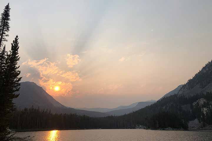
This July, the team found themselves on the mountainside of this once volcanic region with just enough snowpack remaining at high elevation to cool off with a summer snowball fight in short-sleeves.
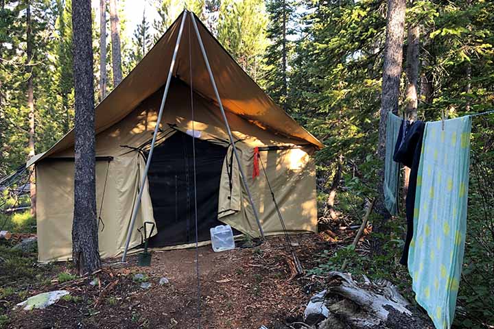
Getting to remote regions for geologic mapping quickly becomes adventurous work. To reach the site, “we drove as far as we could,” said Allison Reid, and then there was “a three-mile hike up to the base camp with equipment coming up via multiple trips on our backs and with an ATV.”
The team made a small canvas fort into their backcountry home. Their food was stored in a bag dangling from tall trees out of bear-reaching range and tents were pitched around the fort.
Fieldwork and trekking the miles to each rocky outcrop dominated their daylight hours.
I have wanted to see geology outside the classroom to get experience and a better understanding,”Steven Tapanes
Guided by high resolution topographic maps, they focused in on previously uncharted intricacies of the region. Reid explained that they referenced “our maps that could show us based on differences in topography where we should go to look for the outcrops.”
With chisels and hammers, they chipped away samples to bring back to the lab.
“When we identified a new rock type that we were interested in doing more analyses on, we would hammer it out of the outcrop and make sure that we documented where it came from and the orientation of the sample. We collected about 20 samples a little bit bigger than a softball in size,” said Webber.
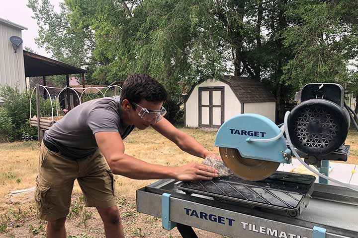
In Bozeman, they cut up the samples with a diamond saw and sent them out to be made into thin sections - slices of rock about the thickness of paper mounted to glass slides.
Under one of Stockton’s microscopes with polarized light, the thin section looks like a kaleidoscope of iridescent colors. To a trained geologist, the shimmering beauty reveals clues about how the rocks formed, their composition and more.
The team was especially excited to look at a thin section from a mysterious formation they found.
“We were walking along a landslide deposit through a boulder field, and we found giant boulders containing what an onlooker might describe as dinosaur eggs. There were thousands of them. We aren’t sure why or how they formed, but we are doing more research and looking into that now,” said Tapanes.
The ‘dinosaur eggs’ are spherical features that crystallized from magma. “They are pretty rare and pretty unusual. They are a scientific curiosity. One of the side projects is to figure out how and why these are where they are,” said Webber.
The team is currently digitizing descriptive information about the rock outcrops they sampled and pairing that information with location coordinates using GIS technology.
“I have wanted to see geology outside the classroom to get experience and a better understanding,” Tapanes said.
He and Reid both got that experience along with stories that will last a lifetime.
East Coast Exploration
Matthew “Rocky” Severs, associate professor of Geology, took his upper-level geology class Mineralogy to the Adirondacks for a weekend field trip this fall. Matthew Gulya called the trip “one for my personal history book.” He was particularly surprised and captivated by the areas that were former mines. “It was enlightening to see how beautiful these areas are despite the fact that they were once mines given the infamy of the mining industry. This trip overall has enhanced my classroom experience as I had the opportunity to put my skills as a geologist to the test in the forms of making field observations and mineral identification.”
Learn more about Stockton's Research Experiences for Undergraduates (REU)